Trekking to Kilik Pass, on the Ancient Route between Pakistan and China

Trekking to Kilik Pass, on the Ancient Route between Pakistan and China

Written by: Muhammad Umer Farooq
Trekking to Kilik Pass, on the Ancient Route between Pakistan and China - Trekking to Kilik Pass, on the Ancient Route between Pakistan and China

Trekking to Kilik Pass, on the Ancient Route between Pakistan and China

The trek to Kilik Pass was unlike any other expedition I have been to. Labelled as the most difficult trek hosted by LUMS Adventure Society (LAS), the high altitude (4800 m) of the pass, appealed to me and I chose it over other options. As an ancient route between Gilgit-Baltistan, Pakistan and Xinjiang, China, Kilik Pass remained significant for centuries before the Karakorum Highway (KKH) was built.

The Beginning

On 21st May, we left Lahore via the Grand Trunk Road and travelled towards Gilgit-Hunza, our destination. After a night-stop at Besham, we experienced the terrible roads of Kohistan. Once crossed, the roads improved and the temperature became colder. The bus cruised along the KKH until at the break of dawn we reached Karimabad. At 8:30 AM, after non-stop travel of 24 hours, we finally arrived at Sost. Sleep and rest deprived, we realized that this was just the beginning, for the actual trek was yet to start.

Day One

At Sost, after a breakfast of eggs, parathas (flatbread) and tea, two coaches took us towards Misgar Valley – a narrow strip of settlement in the Hunza district. The terrain changed to large and barren mountains. Dating back to 1864, Misgar Valley is popular because it lies on the Old Silk Route, connecting the subcontinent to Tashkurgan through Kilik pass and Mintaka pass. At Misgar, we stopped briefly to pick up our guide Basharat Bhai and our porters, before resuming our journey to Kalam Darchi fort.
One hour into the ride, the dust rising from beneath our vehicles made it difficult to breathe. At Kalam Darchi fort, after two and a half hours of stringent security check by the army check post, we were given clearance to move ahead. Running out of time, for it would soon be dark, we were supposed to cover 14 km today in order to reach our campsite, Murkushi.
We embarked on the trek and ten minutes later faced our first challenge. The trail led to a gushing blue river which had to be crossed. We climbed onto a tractor trolley which did the job for us. I have always crossed rivers and streams via bridges but this was a difficult one. The driver displayed courage and expertise in manoeuvring the vehicle, since the strong flow of water made it swing left and right.
Trekking to Kilik Pass hosted by LUMS Adventure Society, on the Ancient Route between Pakistan and China

The first ten minute trek

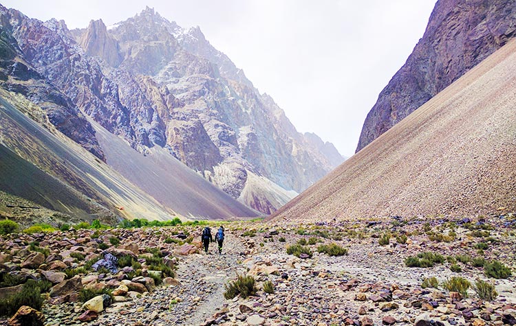
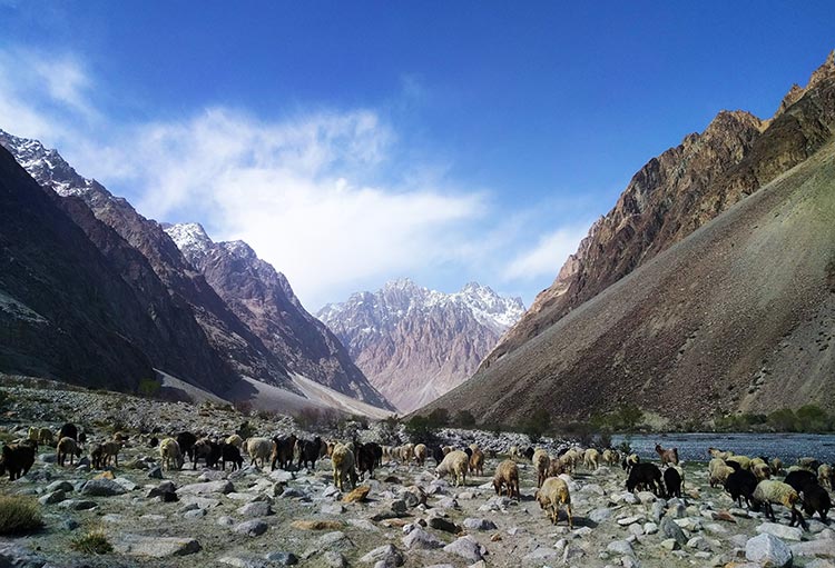
After the river came a spectacular view of the valley. However, the landscape consisted of loose rocks and remnants of landslides, and after an hour's trek, the colours changed to a ruddier and even darker brown. Until this point, the trek had largely been on level ground, but this was soon to change. Our first incline allowed us a glimpse of the mountain we had to camp in front of at Murkushi. Motivated we charged ahead, but the rocks were testing the strength of our boots, and our feet ached from fatigue.
Around 4:30 pm, having covered just 4 – 5 km of the distance, we stopped at a small pasture for lunch break. To replenish our energy, we had the noodles prepared by porters on gas cylinders. We also gained warmth for the trek ahead, as the valley would become increasingly colder.
Racing against time, we knew that the more distance we could cover in daylight, the less we would have to trek in the dark. At dusk, we reached a slightly bigger pasture of lush green grass that soon became a small forest. We hoped that the topography ahead would be similar but to our surprise, we were faced by even more challenging terrain. With the sun gone and night approaching, we continued climbing huge rocks.
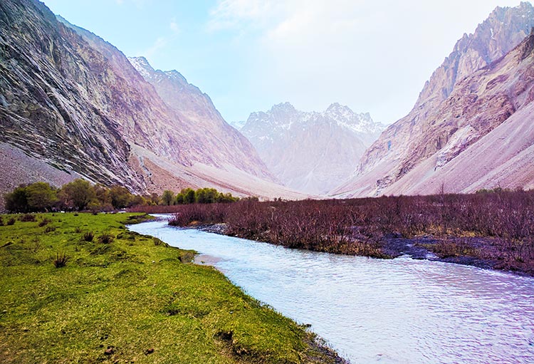
Trekking to Kilik Pass hosted by LUMS Adventure Society, on the Ancient Route between Pakistan and China

The pasture and the river, with the forest to the left

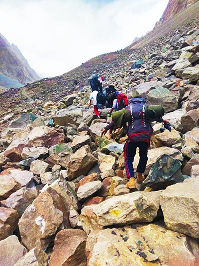
Trekking to Kilik Pass hosted by LUMS Adventure Society, on the Ancient Route between Pakistan and China

The rocky terrain

When night time arrived, we shared our torch lights and helped each other out. The rocks would often shake and slip and many of us fell down. Bruised but undeterred, we would stand up again, for no one could be left behind. At one point, I was petrified by the gushing sound of the ferocious river, which I was unable to see. One wrong step could lead to my fall!
Eventually, we reached Murkushi, where the chilly and biting wind forced us to go inside the camps. After a while, Basharat bhai summoned us to a small hut. The hut was constructed from rocks, and covered with animal dung, which prevented the wind outside from coming in. Large black insects and a few mice scurried about inside, seemingly enjoying the heat. Too tired to be concerned, we gratefully had the local lassi (drink made with goat milk) and fresh roti (flatbread) offered to us by the porters. After enjoying the food, we rushed to the comfort of our camps and sleeping bags.

Day Two

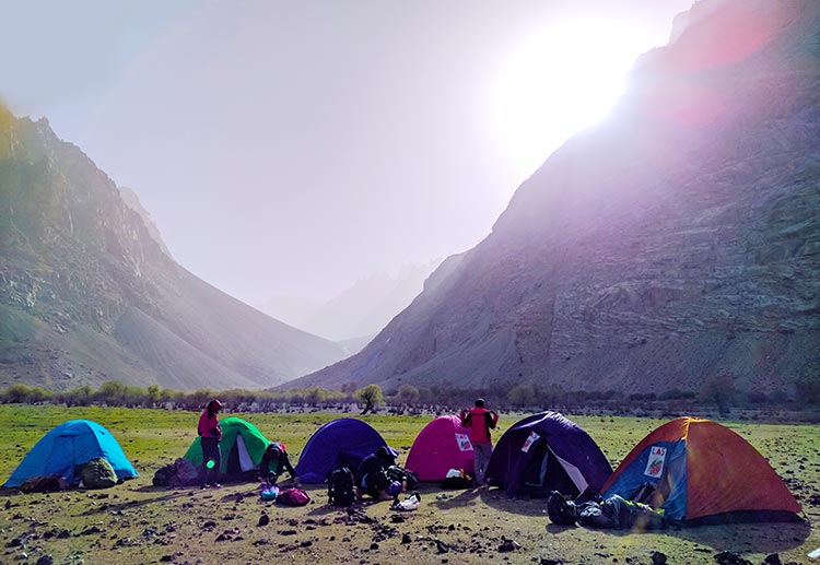
I woke up early next morning, and popped my head out of the camp. Our campsite was a green pasture, surrounded by yak dung. Lured outside by the morning wind, I thought this was the perfect time to answer nature’s call, since nearly everyone else was still asleep. It’s always a good feeling to sit in the wild and ponder over how locals survive like this every day.
Trekking to Kilik Pass hosted by LUMS Adventure Society, on the Ancient Route between Pakistan and China

Murkushi, the first campsite, on the way to Kilik Pass

Soon after, the others woke up and the majestic sun greeted us all. I forgot the difficult last night, and got pumped up for the day ahead. After having cornflakes with warm milk and honey, we left our extra luggage in the hut and started our trek towards Sad Buldi.
Merely half an hour later, we heard locals calling us from behind. Vigorously waving towards us, they seemed to want to tell us something. Basharat bhai went to talk to them and then called us as well.
Trekking to Kilik Pass hosted by LUMS Adventure Society, on the Ancient Route between Pakistan and China

On route to Sad Buldi

We were told that the Pakistan Army had come to prevent us from proceeding further. Information had been received that men from ISIL (the Islamic State) had entered Pakistani territory through Afghanistan. Because of security issues, we could not be allowed to camp at Sad Buldi. If we were to go to Kilik Pass, we would have to cover the entire distance in one day, and return to Kalam Darchi fort.
While the porters made us tea, we came to the conclusion that going to Kilik Pass and returning without camping anywhere was impossible. Our alternative was to visit Chipursan Valley in Gojal. After tea, we started trekking towards Kalam Darchi fort, where our coaches would take us to Chipursan Valley.
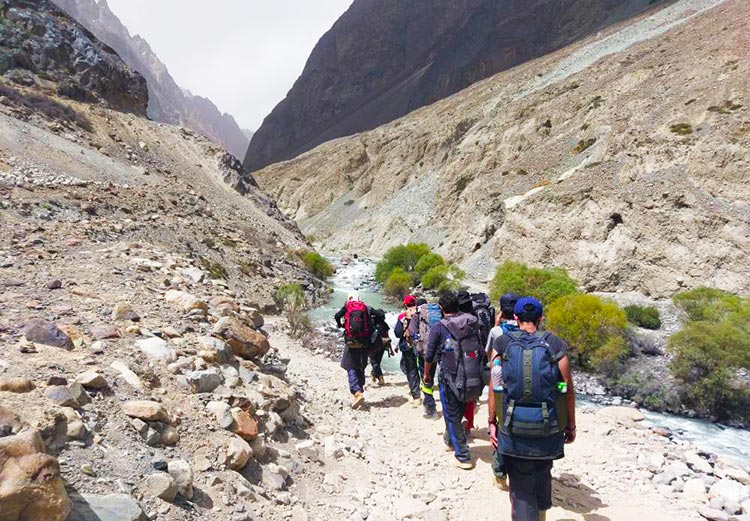
Trekking to Kilik Pass hosted by LUMS Adventure Society, on the Ancient Route between Pakistan and China

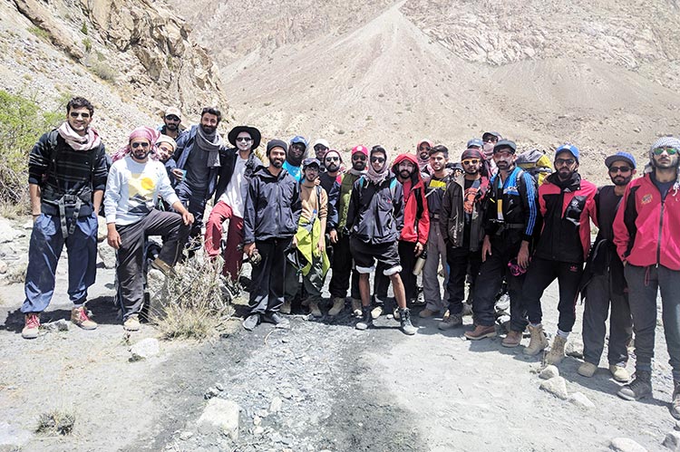
The Group

The End

On returning from Murkushi, I was quite disappointed, and a friend consoled me by saying, “Whenever you visit the mountains, always remember that you might not be able to reach your destination.”
Kilik Pass was a learning experience. Before this, my trips may have been delayed due to landslides or security approvals, but I never had to completely turn back. In this case, though we did not make it to Kilik Pass, we did pass an endurance test, and the lessons cannot be forgotten.

From Skardu to Swat: Searching for Heaven on Earth!

From Skardu to Swat: Searching for Heaven on Earth!

Written by: Ibrahim Younus
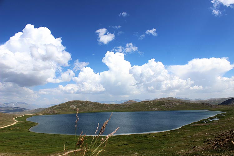
Sheosar Lake, Deosai - Skardu to Swat: Searching for Heaven on Earth

Sheosar Lake, Deosai

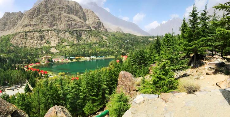
In his 1933 novel, ‘The Lost Horizon,’ James Hilton described Shangri-La as a long lost mystical and harmonious valley. Little did James know that his vision was not just a figment of his imagination, but a site visible to the naked eye. The magnificent resort of Shangri-La is located in the remote area of Kachura Village, Skardu and with its rich history and unique cultural practices, it is a travellers’ paradise. Although the village is a sight to behold in itself, it mainly acts as a hub branching out to various other historically significant villages and towns, which are equally admirable in terms of their beauty and culture.
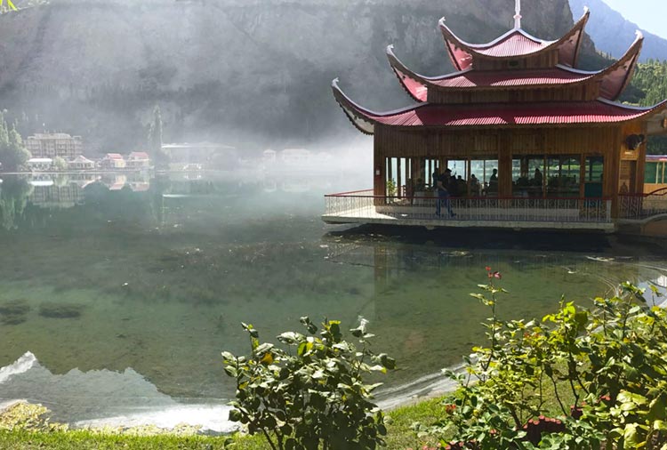
Lakeview Restaurant, Shangrila

Lakeview Restaurant, Shangrila

Recently, I undertook a trip to confirm the rumours of the immense and breathtaking splendour of Shangri-La and its surrounding areas. Upon my arrival, I marvelled at the majesty of the mountains that surrounded me; beauty that cannot be described in words. I was further astounded by the incredible structure of the hotel I would be staying at: the Shangri-La Resort Hotel, which is located on the peripheries of the Lower Kachura Lake. With a variety of rooms which can be booked at economical rates, as well as free wifi and a sublime breakfast menu, my stay at the hotel was a delightful experience. Apart from having excellent room service, the hotel had a luxurious fine dining restaurant, situated atop the Lower Kachura Lake.
Moving northwards from the hotel, I went to visit the famous Kharpocho Fort, which was originally the residence of the Rajas of Skardu. Located atop a hill, the fort overlooks the Rock of Skardu, also known as the Manthal Buddha Rock. At the end of the sixteenth century, the king Ali Sher built the fort. Several enthusiastic guides were present at the site, eager to divulge information pertaining to the fort. Stories about its inauguration and its poignant fall, when it was razed to the ground in 1857, under the supervision of Ranbir Singh, kept me captivated for hours.
Shangrila Resorts

Shangrila Resorts

Approximately two hours away from the hotel was the town of Shigar, which famously houses the elegantly designed Shigar Fort (The “Fort on Rock”). Built in the seventeenth century by the Raja of Amacha Dynasty of Shigar, today the fort serves as a museum and a luxury hotel. It is currently under the stewardship of Serena Hotels, and was undergoing restoration from 1999 to 2005, which reportedly cost a king’s ransom of US $1.4 million. Judging from the presence of foreign tourists, and the employment opportunities generated for the locals, I would say it was money well spent.
At a mere sixty kilometres from the hotel was the serene Deosai National Park. The first eye-catching feature of this vast park was the Sheosai Lake, which stretched for an impressive 2.3 kilometres, with an average depth of 130 feet. As the world’s second highest alpine plain, the park boasts a variety of flora and fauna, as well as the endangered Himalayan Brown Bear. Other noteworthy sites of the park were the Shatong Nala Pull and the Barha Pani Deosai.
I had reserved a special visit for the last day of my trip. Other than being famous for plush green fields and fantastic weather, the Swat plains also boast a series of stunning waterfalls. The route to get there from Skardu is long and arduous, but because of the beauty of the pristine lakes and rugged mountains, the journey time seems to fly.
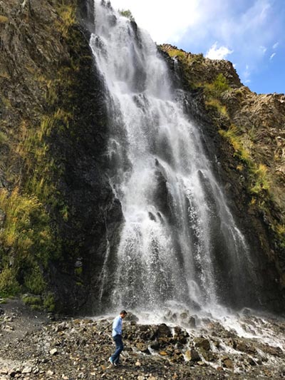
Swat Waterfalls

Swat Waterfalls

Upon arriving at Swat, I quickly made my way towards the waterfalls, since dusk was fast approaching. While chatting with Gul Khan, the local driver who had accompanied me, I learnt that almost 200-350 foreigners visit Swat waterfallsevery year, and he fondly remembers an American tourist saying, “By God! These are even better than the ones in Arizona.” Although, I cannot confirm whether the American was correct or not, I can certainly testify that it was the perfect finale to my trip, for I had confirmed that the rumours I had heard were true; this was indeed heaven on earth.

Deosai Plains: The Land of Giants

Deosai Plains: The Land of Giants

Written by: Muhammad Umer Farooq
The Sheosar Lake (the track on the left leads to Skardu) - Deosai Plains: The Land of Giants

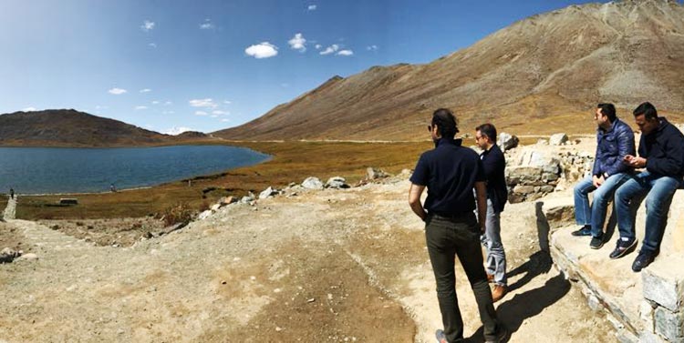
The Sheosar Lake (the track on the left leads to Skardu)

The first time I visited Deosai, I only got a chance to travel through half of it. At 4000m above the sea level, the Land of Giants is affiliated with the supernatural in local culture and literature, and to me, the plateau does seem like paradise. I’d been longing to see it again and recently, I was lucky enough to visit for the third time within two months.
Day 1
Travelling from the town of Astore on a 4x4 jeep towards Deosai National Park, I stopped at Gorikot for a lunch of red beans (daal lobia) and thick beef gravy. After this, the ride was so peaceful that I rested back in my seat and savoured the view. A bluish-green river was flowing on my right, and I remembered how upon first seeing it, I had been reminded of the Neelum River in Azad Kashmir. Some of this water is indeed being fed by the glaciers of Kashmir. Right before entering Deosai, one crosses the army check-post at Chillim, and one route from here takes you towards Burzil Top, Minimerg, Domail and Rainbow Lake in Kashmir, while the other ascending road takes you towards the Deosai National Park. A nominal fee is charged from all those visiting Deosai, which goes towards the park management fund.
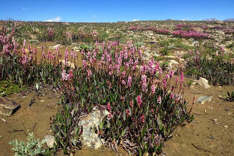
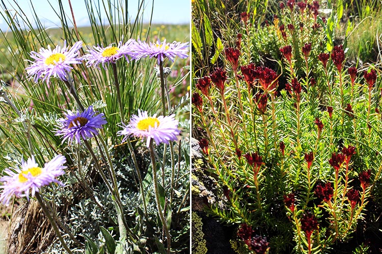
As we drove up towards the Plains, I witnessed fewer and stunted trees because of the extreme altitude. The greenery, in the form of round bushes and small conical trees, struck me as a remarkable wonder of nature. Near the track and beyond in the meadows, I could see wild flowers blooming in shades of pink, red, yellow and blue. The park management informed me that more than 300 varieties of flowers sprout up here in the short spring season, but due to lesser snowfall this year, there was comparatively lesser flora. The park management also raised concerns about the pressures on the wildlife of Deosai, because of an increase in livestock grazing.
The terrain is dotted with pink flowers

The terrain is dotted with pink flowers

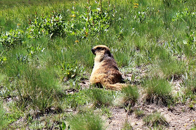
After roughly an hour-long jeep ride, we arrived at our first stop; the stunning Sheosar Lake, which lies at an altitude of 4142 meters. Surrounded by grassy land and green mountains, it is difficult to describe the colour of this lake, which changes quickly based on the changing environs. After a fifteen minute long trek up a cliff, I was able to capture the Sheosar Lake, and the track on the left which goes all the way to Skardu, my destination for the next day. That night, however, I would be camping at Kala Pani, which was still forty-five minutes away by jeep. Away from the noise of the jeep engine, I often heard the sound of the golden marmot. Vibrant birds that I’d never seen in cities were a joy to observe. In the unforgettable moments I spent here, I watched clouds drifting from my right to the left, the sunlight creating striking shades in the lake and on the land around it.
The golden marmot

The golden marmot

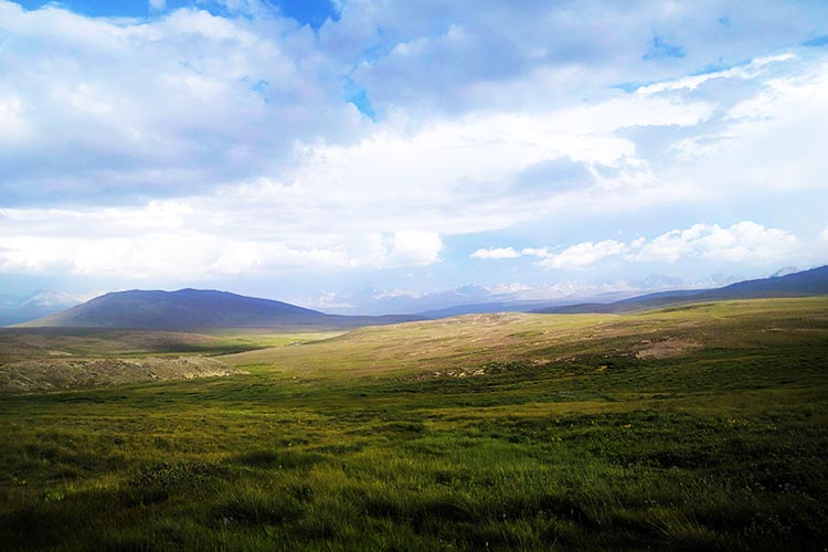
Upon reaching the campsite, the few locals who recognized me were delighted. There was nearly an hour left before it would be dark, so I decided to climb a hill and watch the sunset. As I made my way up, I came across the burrows of golden marmots, curiously watching me and perhaps whispering to other marmots in the colony about my arrival. At the hilltop, the evening wind was chilly and around me, pink flowers were dancing in the breeze, almost glowing at this golden hour. The view was very rewarding, as I was able to see the vastness of the Deosai Plains, both before and behind me. Watching the thick golden clouds drifting in the wind was a perfect end for an exhilarating climb.
The Deosai Plains

The Deosai Plains

Back at the campsite, I ordered Chicken Karahi and ate it while listening to my host’s stories about brown bears.
Day 2
When I woke up in the morning, the sun had already risen from behind the mountains. Around 7 am, I stepped out of my tent to find a layer of ice on my slippers and camp, from last night’s precipitation. Before leaving for Bara Pani and Skardu, I enjoyed the view of a herd of horses that had come to drink water from Kala Pani. Kala Pani’s strange name can be attributed to the black stones found in the stream bed.
In less than an hour, my local guides drove me to Bara Pani, which was also a water stream like Kala Pani. There was a larger camping site here, and tourists could order food as well. Bara Pani is the core zone of the brown bear habitat, and bears are spotted here more often than at Kala Pani. I wistfully hoped that I would also get to see the brown bear this time, but remained unlucky.
A variety of flowers

A variety of wild flowers

After this, there was a drastic change in the landscape because the mountains in Skardu are more barren, and landslides are more common on this side of Deosai than on the Astore side. In another hour’s time from Bara Pani, I was at the check-post leading towards Skardu, and the journey ahead consisted of some dangerous twists and turns. Nevertheless, I personally prefer the landscape between Bara Pani and the Skardu check-post, because the mountains are steeper and therefore, more majestic.
As we drove further away, I realized that I can now claim to have seen the entire Deosai Plateau, and yet I felt as if the Land of Giants would call me back soon. After all, I still have to see the brown bears, and I’m sure the plains will keep surprising me with their hidden wonders. Since going off track is not allowed in order to protect the wildlife, perhaps one day I can ride a horse in this wilderness and explore the lands beyond.

Karachi Pakistan


Shoppers' Paradise


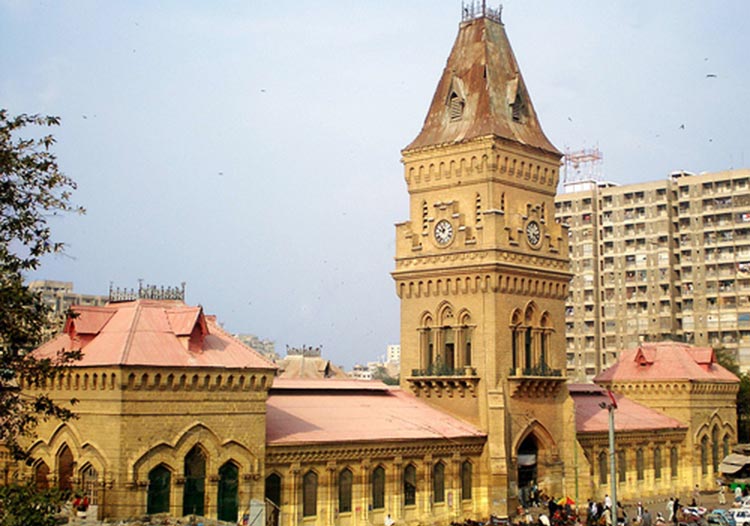
The Empress Market, for wives of government officials and foreign diplomats (source: Flickr/Iqbal Khatri) - Evolution of Saddar Bazaar Karachi into a Shoppers Paradise

The Empress Market, for wives of government officials and foreign diplomats

On February 3, 1839, the HMS Wellesley bombarded the Fort of Manora. Karachi was enveloped in a cloud of smoke, and within four days, a surrender agreement was signed between the Talpur government and Sir Frederick Lewis Maitland, Commander-in-Chief of her Brittanic Majesty’s naval forces in the East Indies. Under the terms of the surrender document, the British were to control Manora and had a right to station troops on the Karachi mainland as well. The civil administration of the city, however, was to remain in Talpur hands.
The first British camp was set up in the plain between the old city and an ancient garden in its outskirts, known as Rambagh. This garden is now known as Arambagh, and houses an important mosque, while the camp area subsequently came to be known as the Serai Quarter.
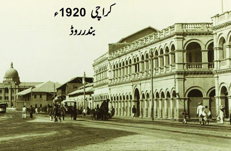
Evolution of Saddar Bazaar Karachi - Bunder Road (now M.A. Jinnah Road) in 1920

Bunder Road (now M.A. Jinnah Road) in 1920 (source: Business Recorder)

“Shortly after the setting up of the military camp, Saddar Bazaar, known administratively as Saddar Quarter, was laid out to serve the British cantonment. The British forced the Mirs to exempt all goods sold in the bazaar from transit duty, so as to encourage traders to open shops in Saddar. Though the Talpur government had to give in to British pressure on the question of transit duty, it effectively discouraged the locals from setting up trade or commerce in Saddar. So it was only after the British annexation of Sind in 1843 that Saddar became a viable commercial area where European ladies could shop in a not too unfamiliar environment and purchase “the latest things from home, weather fashions, in dress, Easter eggs or Christmas Cards, the newest sources, the most novel condiments and the best of Wines.” However, it was not until the late 1920s that Saddar became a competitor to the old town’s well entrenched business interests.
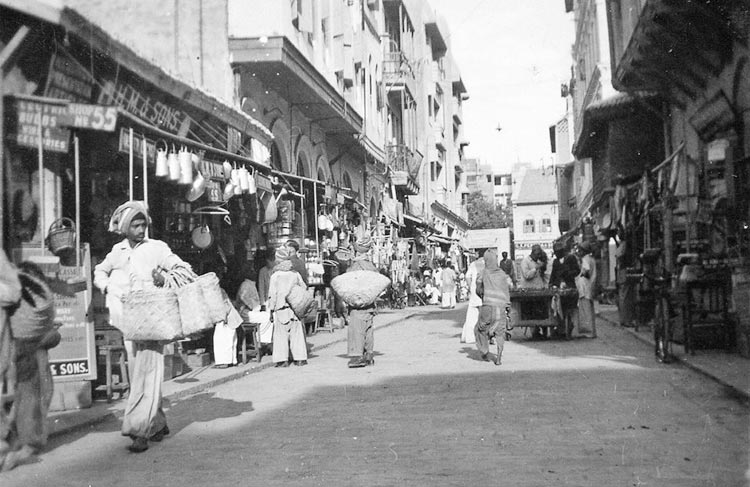
As Karachi grew, Saddar became the centre of the city, and by the 1940s boasted cinemas, restaurants, bars, billiard-rooms and bookshops, in addition to markets, churches, community halls and libraries. Its architecture, built of Gizri stone, was human in scale, in the Gothic and Renaissance revival styles. The masons who worked on Saddar’s buildings were from neighbouring Rajasthan.”[i]
Saddar Bazaar Karachi in the early 1940s - Evolution of Saddar Bazaar Karachi

Saddar Bazaar Karachi in the early 1940s (source: Historic Karachi)

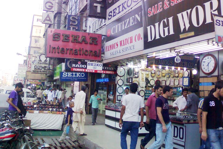
After Partition, Saddar continued to be the social and cultural centre of the new capital. The wives of government officials and foreign diplomats went shopping for their provisions at Empress Market, and the Saddar tea houses and bookshops were the haunts of students, intellectuals and politicians. Today, Saddar houses in abundance a wide variety of consumer electronics, items of clothing, jewelry, and antiques. It is the busiest place in Karachi, always brimming with activity, and one that caters to the needs of people from all over the city. Say you need your watch repaired; the strap or bracelet is damaged, or you’d like to get the battery and seals replaced, perhaps. Take to Zaibunnisa Street and you’ll find an array of shops and kiosks set up for this very purpose. Within an hour, and for as low as Rs. 100, you will walk out with your timepiece serviced to perfection. The street is famous for having numerous branded watch, clock and jewelry shops, as well as shoe stores by the likes of General Boot House and Sputnik Footwear.
The famous watch market in Saddar - Evolution of Saddar Bazaar Karachi

The famous watch market in Saddar (source: Mapio.net)

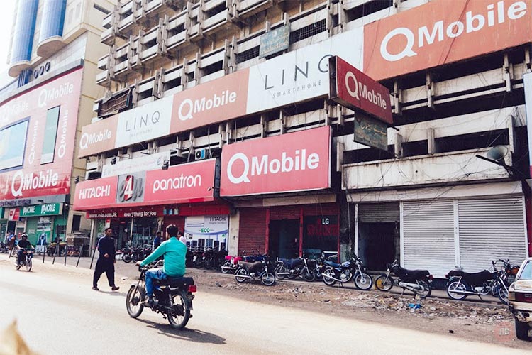
The Abdullah Haroon Road deserves an honorary mention whenever Saddar is the topic of discussion. It is bustling with shoppers interested in all types of consumer electronics, ranging from juicers and blenders to ACs and fridges. Pakistan’s largest mobile market is situated on this very road, offering an endless variety of mobile and corded phones. Also located here is the Cooperative Market, famous for hosting hundreds of stitched and unstitched gents’ clothes shops. Much to the convenience of shoppers, the market also has renowned tailor shops, some of which boast having stitched suits and jackets for Quaid-e-Azam, Sardar Abdur Rab Nishtar, and a more recent client by the name of General Pervez Musharraf!
Pakistan's largest mobile market, located on Abdullah Haroon Road - Evolution of Saddar Bazaar Karachi

Pakistan's largest mobile market, located on Abdullah Haroon Road (source: Panoramio/Aamir Bilal)

The Regal Chowk is another attraction for those looking to buy electronics. Regal Trade Centre was named after Regal Cinema, and has now been converted into a shopping centre, which is the place to be if you’re looking to buy camera equipment, sound systems, and loudspeakers used primarily in mosques, and for marches and parades. The area is also home to photography studios and is constantly buzzing with the chatter of families getting group photos to mark important events, and students and job candidates getting passport size photos for their various applications.
An account of Saddar is obviously incomplete without the mention of Zainab Market. It’s the place with the busiest traffic, the loudest car horns, and the most excited shoppers bustling in and out of shops, giddy with their purchases. There is chatter, laughter, and lots of bargaining. Pedestrians will find betel leaf stains smeared in alleys and pathways, fruit vendors with their stalls set at the very edge of the footpath, and clothes in dashing colors swinging from the shops’ ceilings. It truly is a sight to behold. Zainab Market is a one-stop solution to all your clothing needs, as it has something for everyone. There are branded shoes, shirts and jackets, as well as master copies of the same items available at much more affordable prices. The diversity of items on sale is such that you will find shops for sportswear alongside those for brides and grooms on the same street.